Skip to content
Etusivu » News

News

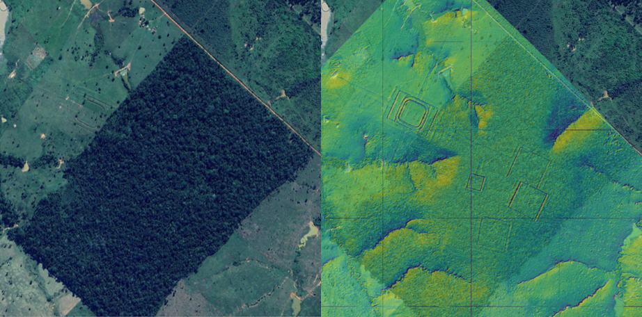
Left: A geoglyph visible in a satellite image of a cleared forest opening. Right: Geoglyphs identified in a hillshade surface model generated from a LiDAR point cloud from the same area.

A surprising technique helps Finnish researchers make a groundbreaking discovery in the Amazon – method typically used in forest research

  • by

In a Finnish-led study, a groundbreaking archaeological discovery was made when laser scanning of the Amazon rainforest revealed thousands of traces of the ancient Aquiry… Read More »A surprising technique helps Finnish researchers make a groundbreaking discovery in the Amazon – method typically used in forest research