
Skip to content
Etusivu » Arkistot V Luoto

V Luoto

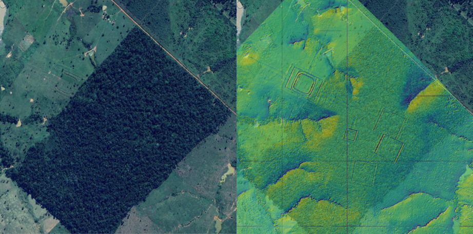
Left: A geoglyph visible in a satellite image of a cleared forest opening. Right: Geoglyphs identified in a hillshade surface model generated from a LiDAR point cloud from the same area.

A surprising technique helps Finnish researchers make a groundbreaking discovery in the Amazon – method typically used in forest research
  • by

In a Finnish-led study, a groundbreaking archaeological discovery was made when laser scanning of the Amazon rainforest revealed thousands of traces of the ancient Aquiry… Read More »A surprising technique helps Finnish researchers make a groundbreaking discovery in the Amazon – method typically used in forest research

Kuva metsästä ylhäältäpäin, puiden keskellä hakkuukone

Researchers predict: Forestry is switching to the precision level of individual trees, which will benefit biodiversity and the owners’ wallets

  • by

Finland’s forests will soon be managed with the precision of individual trees. According to researchers from the Finnish Geospatial Research Institute of the National Land… Read More »Researchers predict: Forestry is switching to the precision level of individual trees, which will benefit biodiversity and the owners’ wallets